
Moat Lane with Upper Mill Lane on the right.
Left Image: Author - Phyllis Nicklin, Copyright - MLA West Midlands and the University of Birmingham.
Left Image Date: 05/08/1960.
Right Image Date: 15/11/2018.
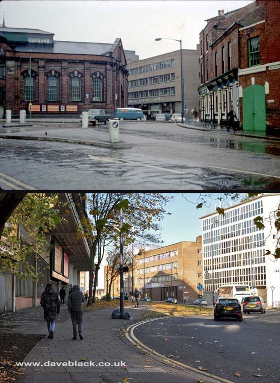
The road to the left is Moat Row, the building is Smithfield Market (built 1883, extended 1892 and 1903).The road in the centre is Moat Lane, and on the right is The Drovers' Arms at the corner of Smithfield Street and Bradford Street.
Upper Image: Author - Phyllis Nicklin, Copyright - MLA West Midlands and the University of Birmingham.
Upper Image Date: 25/09/1968.
Lower Image Date: 15/11/2018.

Butcher's Hide, Skin, Fat and Wool Co. Ltd. Located on Bradford Street - between Barford Street and Rea Street, Digbeth
Left Image: Author - Phyllis Nicklin, Copyright - MLA West Midlands and the University of Birmingham.
Left Image Date: 28/11/1968.
Right Image Date: 15/11/2018.
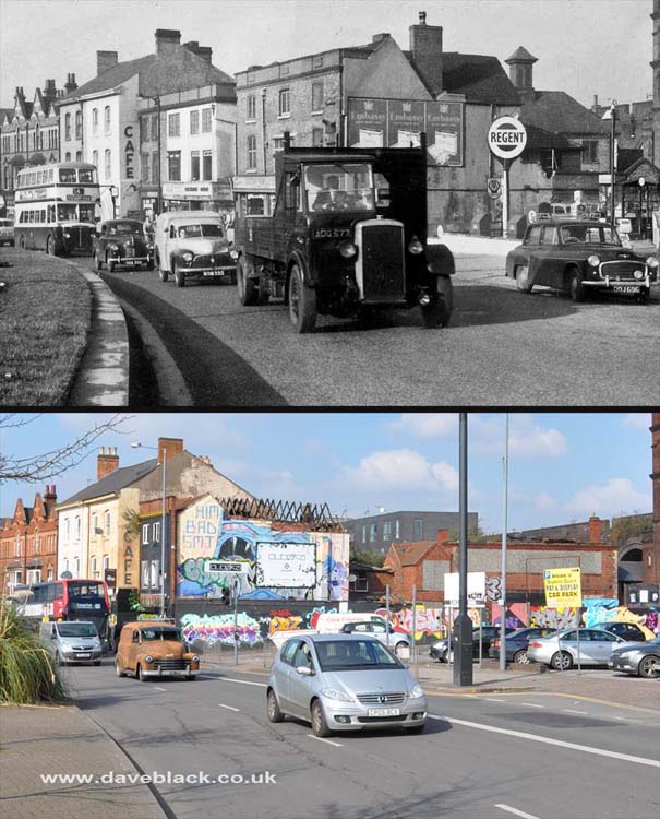
Digbeth High Street - Looking towards the city centre.
Upper Image: Author, and copyright status not known.
Upper Image Date: Early 1960's.
Lower Image Date: 06/03/2020.
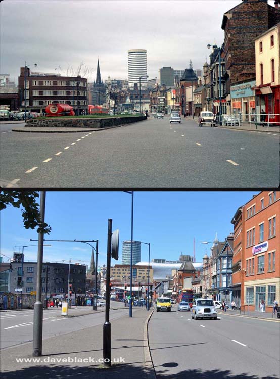
High Street Deritend - Looking towards the Bull Ring, Digbeth Coach Station is on the left of the picture, the building to the right in more recent image is South & City College.
Upper Image: Author - Phyllis Nicklin, Copyright - MLA West Midlands and the University of Birmingham.
Upper Image Date: 15/03/1968.
Lower Image Date: 25/06/2018.
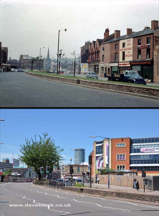
High Street Deritend - The buildings in the older image were demolished and is now a car park for the Custard Factory, the building on the right in the more recent image is South & City College.
Upper Image: Author - Phyllis Nicklin, Copyright - MLA West Midlands and the University of Birmingham.
Upper Image Date: 05/08/1960.
Lower Image Date: 25/06/2018.
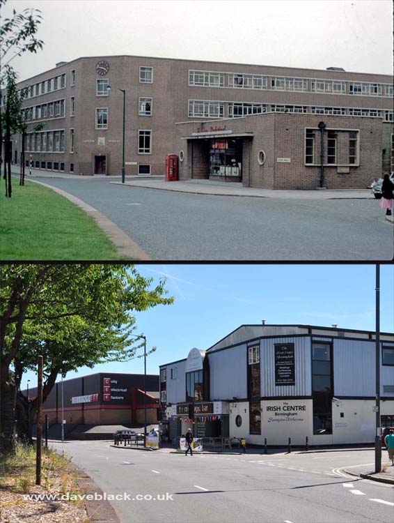
Irish Centre - The building in the foreground used to be a restaurant, it is now 'The Irish Centre', and apart from the circular window at the front it probably wouldn't be recognised as the same building. The building in the background was Thomas, Haddon, & Stokes, an engineering company. That building was demolished and replaced with small commercial units.
Upper Image: Author - Phyllis Nicklin, Copyright - MLA West Midlands and the University of Birmingham.
Upper Image Date: 05/08/1960.
Lower Image Date: 25/06/2018.
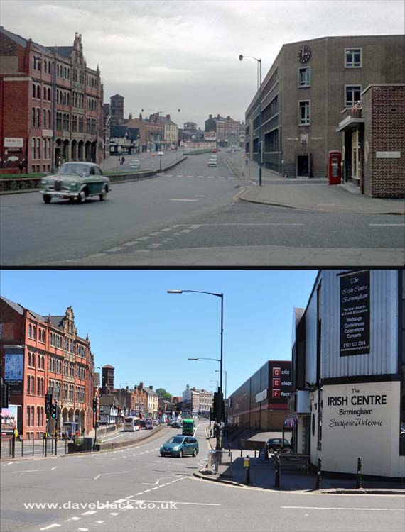
Digbeth High Street - Looking towards Bordesley/Camp Hill with the Irish Centre on the right and the Custard Factory on the left.
Upper Image: Author - Phyllis Nicklin, Copyright - MLA West Midlands and the University of Birmingham.
Upper Image Date: 15/03/1968.
Lower Image Date: 25/06/2018.

The Old Crown - On the corner of Heath Mill Lane; the oldest Pub/Inn in Birmingham, the front of the building shows the number 1368, some believe that this is when it was built, however some historians say that this style of architecture did not to appear until about 100 years later.
Upper Image: Author - Phyllis Nicklin, Copyright - MLA West Midlands and the University of Birmingham.
Upper Image Date: 05/08/1960.
Lower Image Date: 25/06/2018.
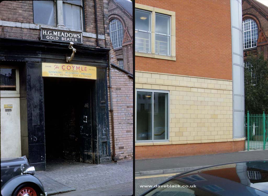
Workshop - H.G Meadows, 'Gold Beater' and 'The Coymle Manufacturing Co' on Floodgate Street is there no more, South & City College is there now. The photo on the right was taken by me on 13/09/2008, I did try capturing a more recent photo, but the tree in the image on the right has since grown and covers the only identifiable feature - the window of Floodgate Street School behind.
Left Image: Author - Phyllis Nicklin, Copyright - MLA West Midlands and the University of Birmingham.
Left Image Date: 05/08/1960.
Right Image Date: 13/09/2008.