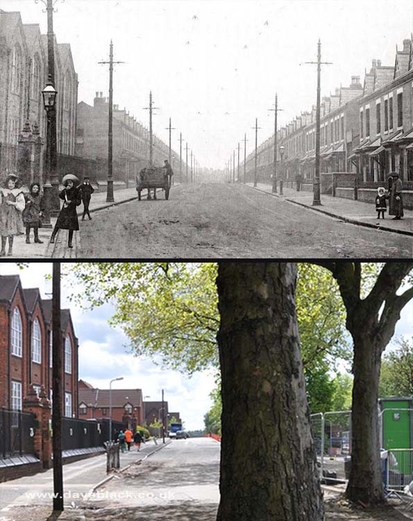
Byron Road, Small Heath – Demolition of the houses to the right of Byron Road began c1981 making way for Small Heath Highway (a dual carriageway to bypass a busy section of the Coventry Road). Photos taken close to Golden Hillock Road..
Upper Image: Author, and Copyright status not known.
Upper Image Date: 1905.
Lower Image Date: 18/05/2021.

The Armoury Road entrance to the BSA, photo taken at the junction with Golden Hillock Road, Small Heath, Birmingham.
Upper Image: Author - Phyllis Nicklin, Copyright - MLA West Midlands and the University of Birmingham.
Upper Image Date: 23/07/1953.
Lower Image Date: 25/10/2018.
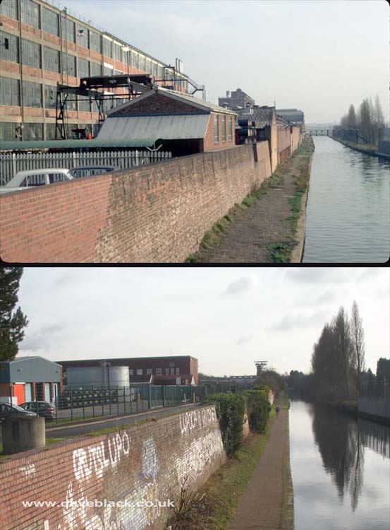
Grand Union Canal - Viewed from the bridge on Golden Hillock Road, Small Heath. The BSA Factory is the large building in the upper photo (demolished in the mid to late 1970's).
Upper Image: Author - Phyllis Nicklin, Copyright - MLA West Midlands and the University of Birmingham.
Upper Image Date: 12/11/1968.
Lower Image Date: 11/01/2019.
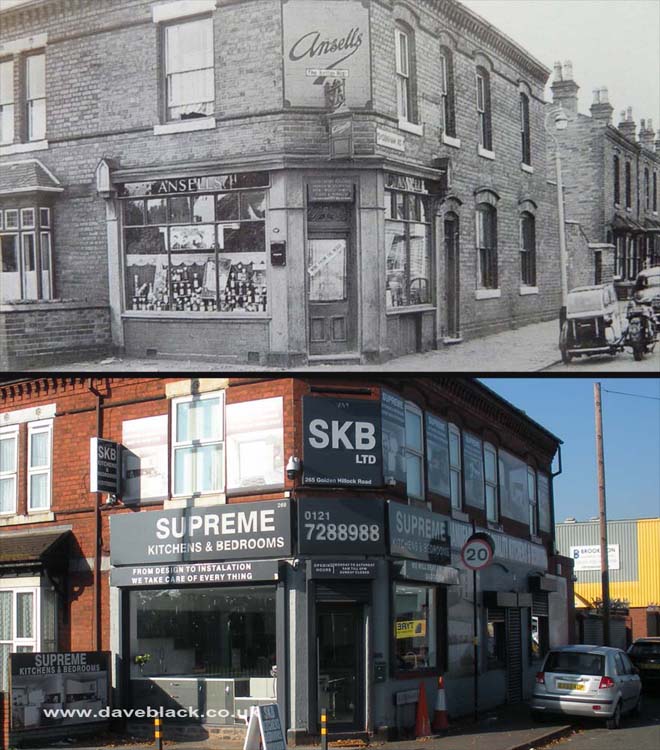
Outdoor/Off License - The main business of shops like these were to sell alcoholic beverages, they also sold popular tobacco brands, and snacks, such as crisps, peanuts etc, but not much else. Located on the corner of Sydenham Road and Golden Hillock Road, Small Heath, Birmingham.
Upper Image: Author, and Copyright status not known.
Upper Image Date: 1961.
Lower Image Date: 10/10/2018.
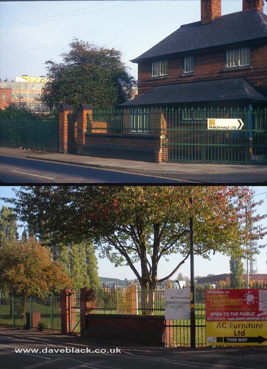
The Lodge at the entrance to the grounds of the BSA. Old maps show that there was a lodge here long before the BSA was built. When I was young the grounds were known as 'The Beeza', I used to play in there, it had almost everything a young lad wanted in it: - a canal, a river, a railway line, and a good supply of abandoned cars to play in.
Upper Image: Author - Phyllis Nicklin, Copyright - MLA West Midlands and the University of Birmingham.
Upper Image Date: 12/11/1968.
Lower Image Date: 10/10/2018.

BSA In The Distance - The 'Birmingham Small Arms' factory in the distance, also known as the 'BSA', and also known as the 'Beeza'. The shop on the right hand side was another outdoor/off license, less than a hundred yards/metres from the Sydenham Road shop, this one was demolished circa1990.
Upper Image: Author - Phyllis Nicklin, Copyright - MLA West Midlands and the University of Birmingham.
Upper Image Date: 23/07/1953.
Lower Image Date: 10/10/2018.
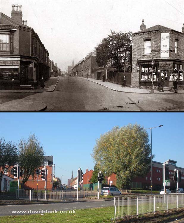
Saint John's Church in The Distance - Looking up Saint John's Road from Warwick Road, Sparkhill/Greet, Birmingham.
Upper Image: Author, and Copyright status not known.
Upper Image Date: Not known.
Lower Image Date: 10/10/2018.

Westwood's Fruit and Vegetables - The shop directly opposite was also owned by them and sold fresh fish. Located on the corner of Durham Road and Stratford Road, Sparkhill, Birmingham.
Upper Image: Author, and Copyright status not known.
Upper Image Date: Not known - possibly 1970's.
Lower Image Date: 10/10/2018.
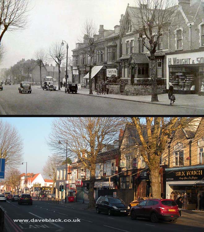
A section of Stratford Road, Sparkhill - it is between Weatheroak Road and Inglewood Road. H Wright & Sons was a bread/cake shop, and Turton was a jeweller, I'm not sure about the big house in the middle, it could have been a doctors surgery.
Upper Image: Author, and Copyright status not known.
Upper Image Date: Not known - possibly early 1950's.
Lower Image Date: 14/12/2018.
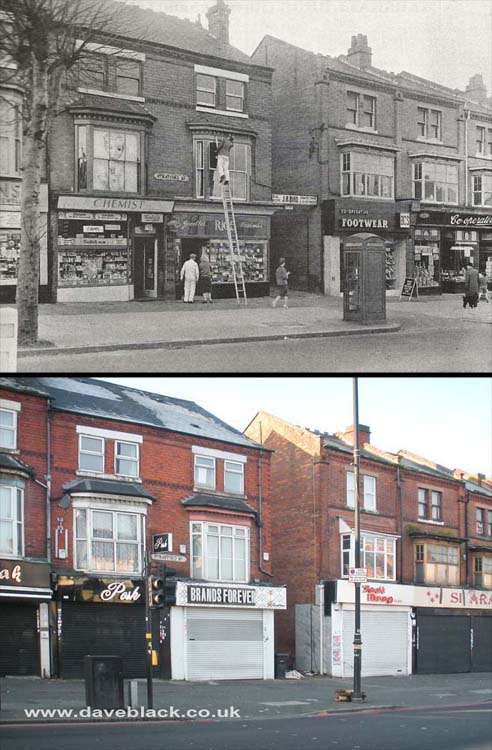
A section of Stratford Road, Sparkhill - located opposite the junction with Warwick Road.
Upper Image: Author, and Copyright status not known.
Upper Image Date: Not known, possibly early 1970's.
Lower Image Date: 14/12/2018.